A Landscape
Shaped by its River
The Tennessee River stretches 652 miles through four states, shaping communities, ecosystems, and economies along its course.
As a first step in developing the Planning + Design Standards, the team compiled an Existing Conditions report that explores the river’s history, culture, ecology, management, recreation, demographics, and economic roles, revealing how its past and present are deeply intertwined.
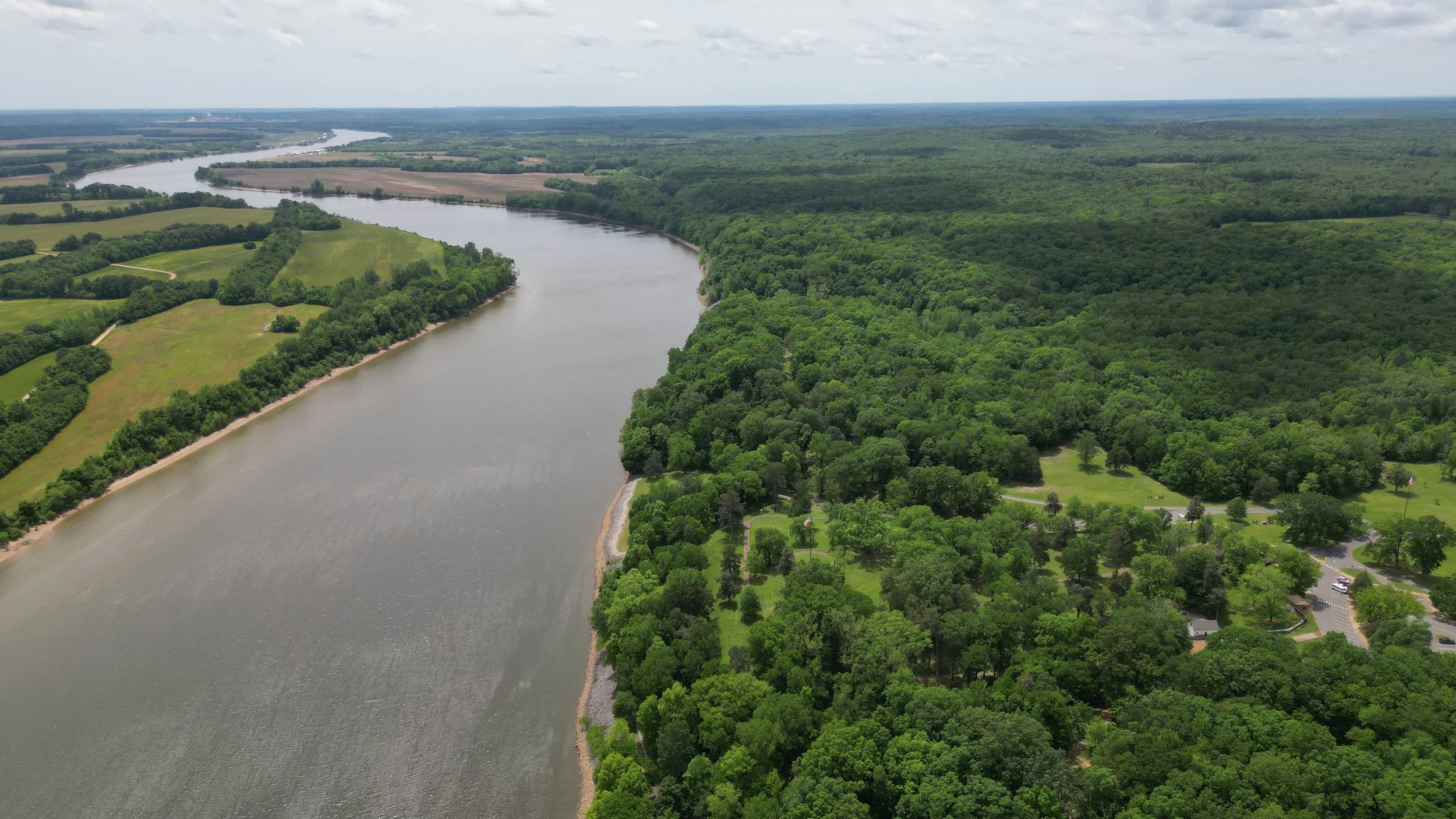
River As A
Way Of Life
For millennia, Indigenous peoples lived along the river, until forced removals like the Trail of Tears reshaped the region.
Later, the river played roles in the Civil War and 20th-century modernization through the Tennessee Valley Authority (TVA), whose dams redefined not only the river’s flow but also the social and economic development of entire communities.

Map with points of interest throughout history, including routes of the Trail of Tears, archeological sites, and important landings and crossings.
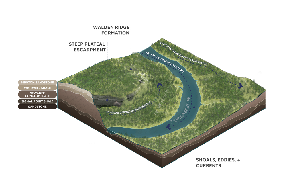
Axonometric diagram illustrating the Tennessee River Gorge and the change in historic flow.

Axonometric diagram illustrating Blythe Ferry crossing, an important landing site along one of the Trail of Tears routes.

Axonometric diagram illustrating Decatur, Alabama around the Civil War and Reconstruction era, highlighting the burned fort and historic Freedmen's town.

Axonometric diagram illustrating Wilson Dam shortly after construction, showing shoals as well as the footprint of the previous islands.
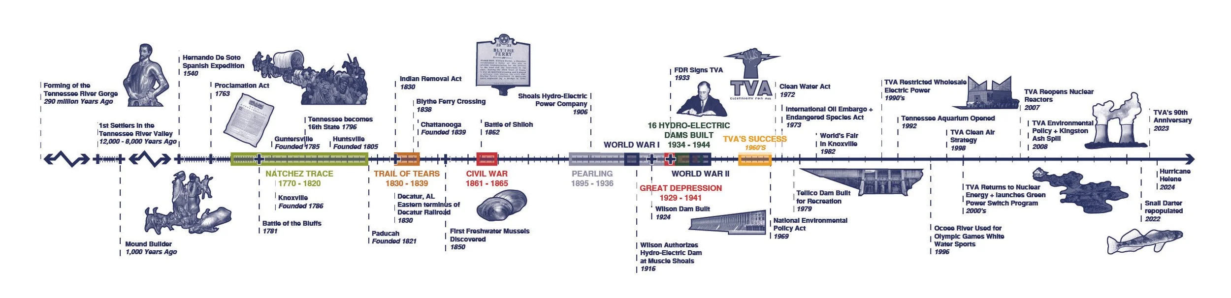
Timeline with important historical events from the formation of the river to the present.
From River To Reservoir
Management of the river today is shared by the Tennessee Valley Authority (TVA), state and federal agencies, and private landowners, balancing energy, navigation, ecology, flood control, and recreation.
These overlapping jurisdictions pose both challenges and opportunities for coordinated planning, especially as environmental, energy, and recreation pressures evolve.
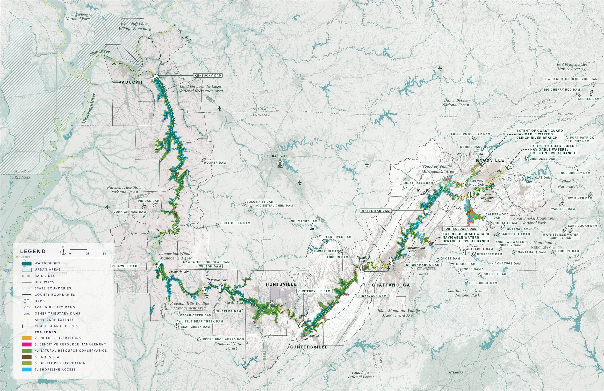
Map showing TVA management zones, including project operations, sensitive resource management, natural resource conservation, industrial, developed recreation, and shoreline access.
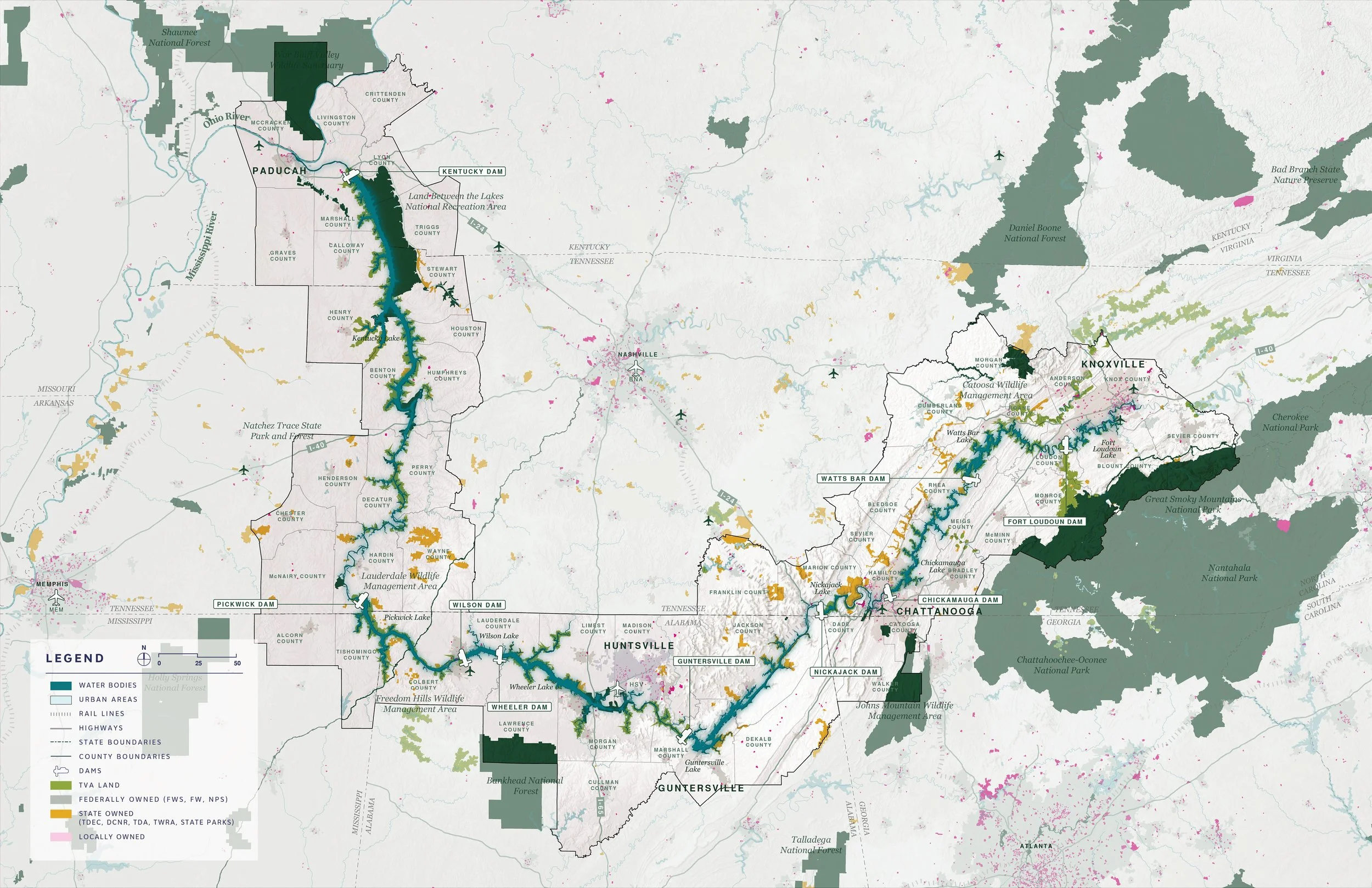
Map highlighting land management throughout the region, including TVA, Federal, State, and Locally owned lands.
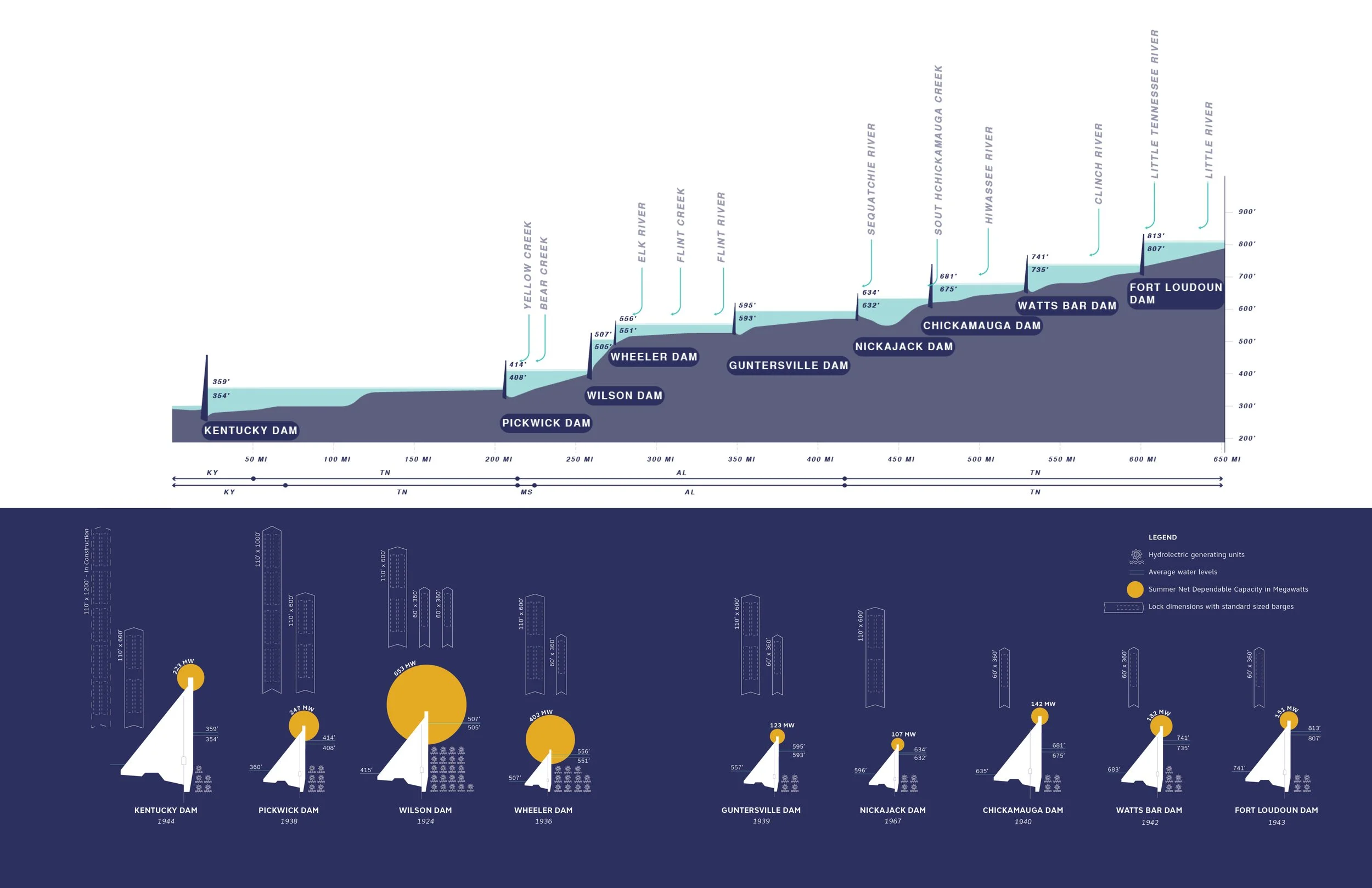
Diagram showing the elevations and scale of all nine dams along the Tennessee River.

Image of paddlers locking through a dam along the river.
A Fragmented River Basin
The Tennessee River Basin is one of the world’s most ecologically rich regions, hosting unique species across varied landscapes from mountains to wetlands.
However, the shift to dam-controlled reservoirs has altered ecosystems. Some species have adapted to these lacustrine environments, while others have declined due to habitat fragmentation, pollution, invasive species, and disrupted hydrology.

Map showing habitat cores throughout the region.

Map with ecological sensitivity values based on criteria developed by Biohabitats.
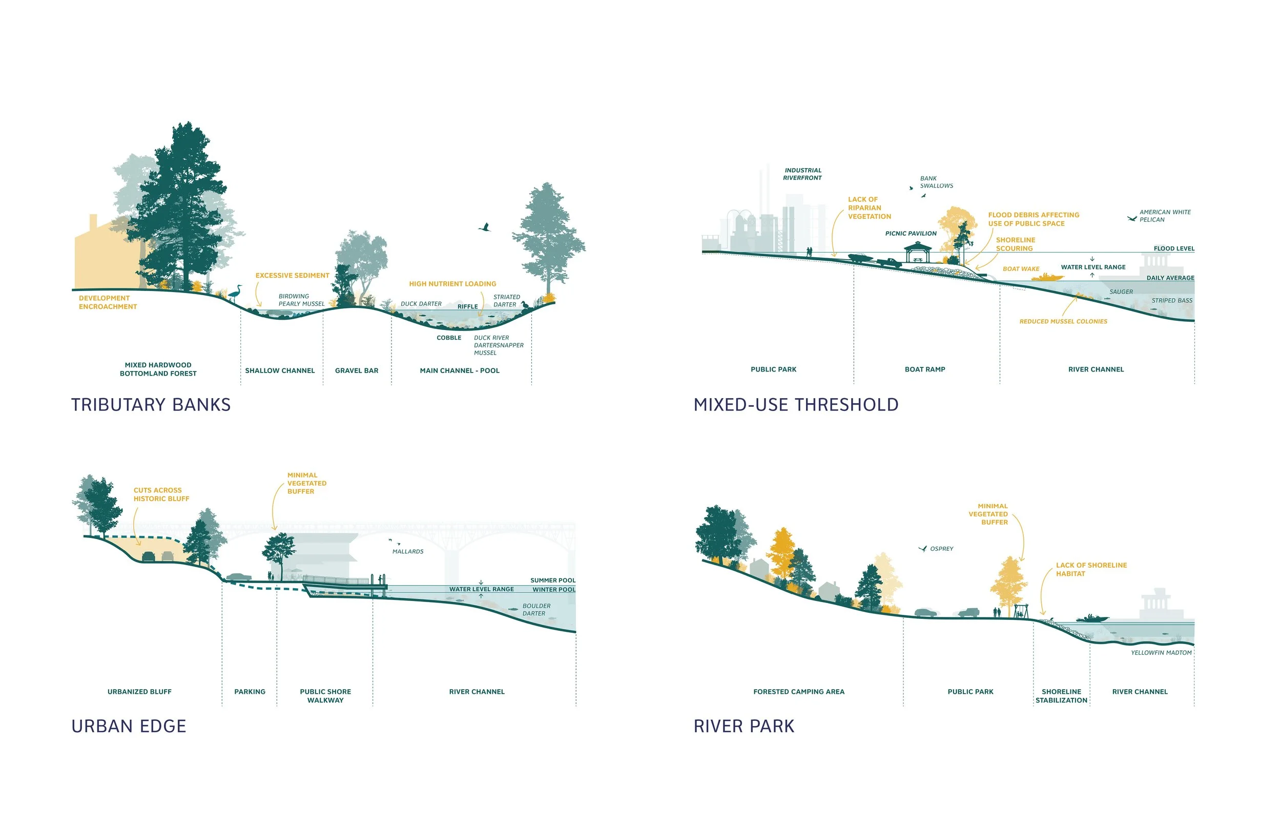
Four sectional diagrams breaking down various edge conditions, including tributary banks, mixed-use thresholds, urban edges, and river parks.

A section cutting through Wilson Dam, illustrating the ecology and infrastructure above and below.

Diagrammatic sections showing a variety of habitat types throughout the region, highlighting species of note.
The River as Park
The Tennessee River is both a vital economic corridor and a recreational destination, but access is greatly varies along its reach.
While some stretches support well-developed recreational economies, others remain underutilized or inaccessible due to shoreline privatization, lack of infrastructure, or environmental degradation.

Set of six maps showing access to marinas, camping and trails, motorized boat launches, parking and drivesheds, carry-in boat launches, and general transportation networks.
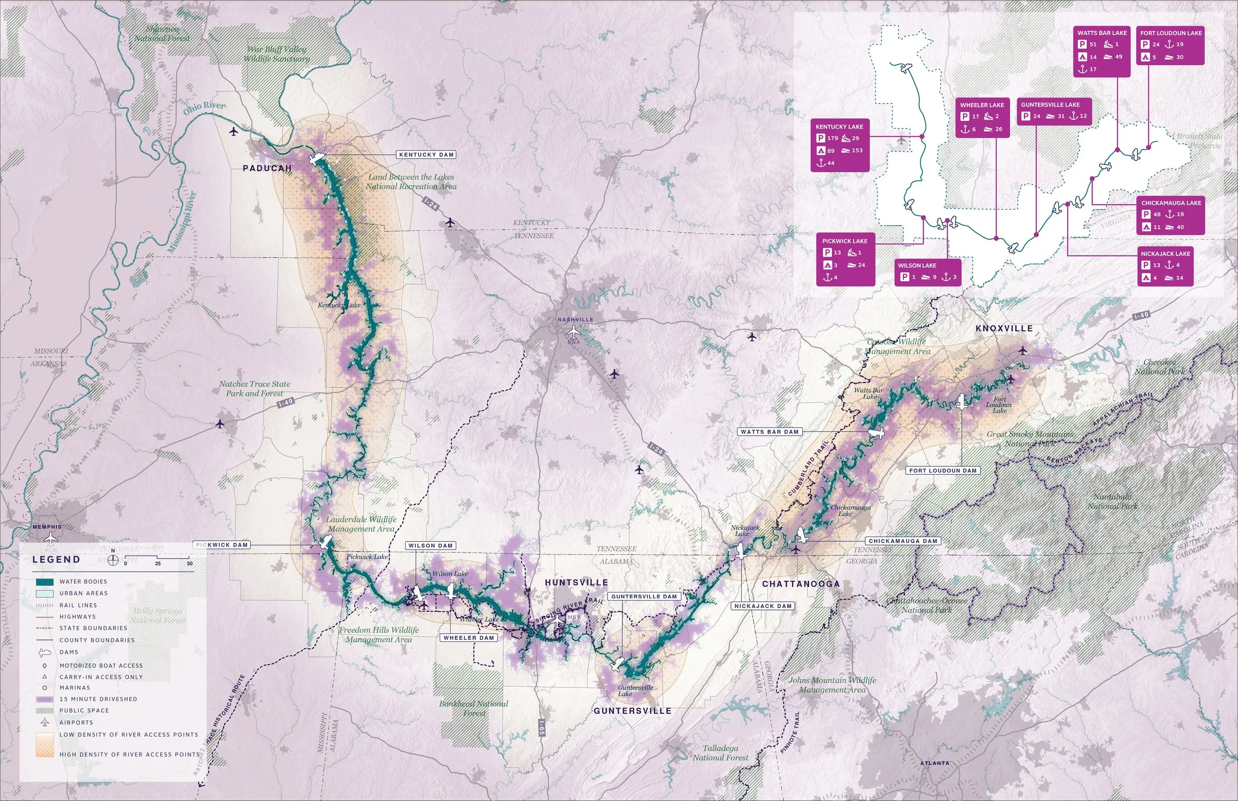
Map showing a 15 minute driveshed along the river, along with public space and diagrammatic density of access points.

Four axonometric diagrams showing access at a boat launch, campground, kayak launch, and marina, with a sectional diagram below showing a list of access points for various segments.
A Delicate Balance at Risk
Pollution, aging infrastructure, and legacy land-use decisions create uneven environmental risks across the basin.
Without coordinated resilience strategies, communities and ecosystems remain vulnerable, but basin-wide planning could unify restoration, infrastructure, and health goals.

Map juxtaposing future days over 90 degrees with the 1% annual chance flood.

Set of maps showing shifts in hardiness zones, days over 90, and annual precipitation over the 90th percentile from 1980 to 2099.

Map highlighting pollution and industry along the river, including brownfield sites, combined sewer overflows, and petrochemical terminals.
Read the Full Document
Access the complete Tennessee RiverLine Existing Conditions Report on our Resources Portal. The full document provides an expanded background that complements this summary.