
A Landscape
Shaped by its River
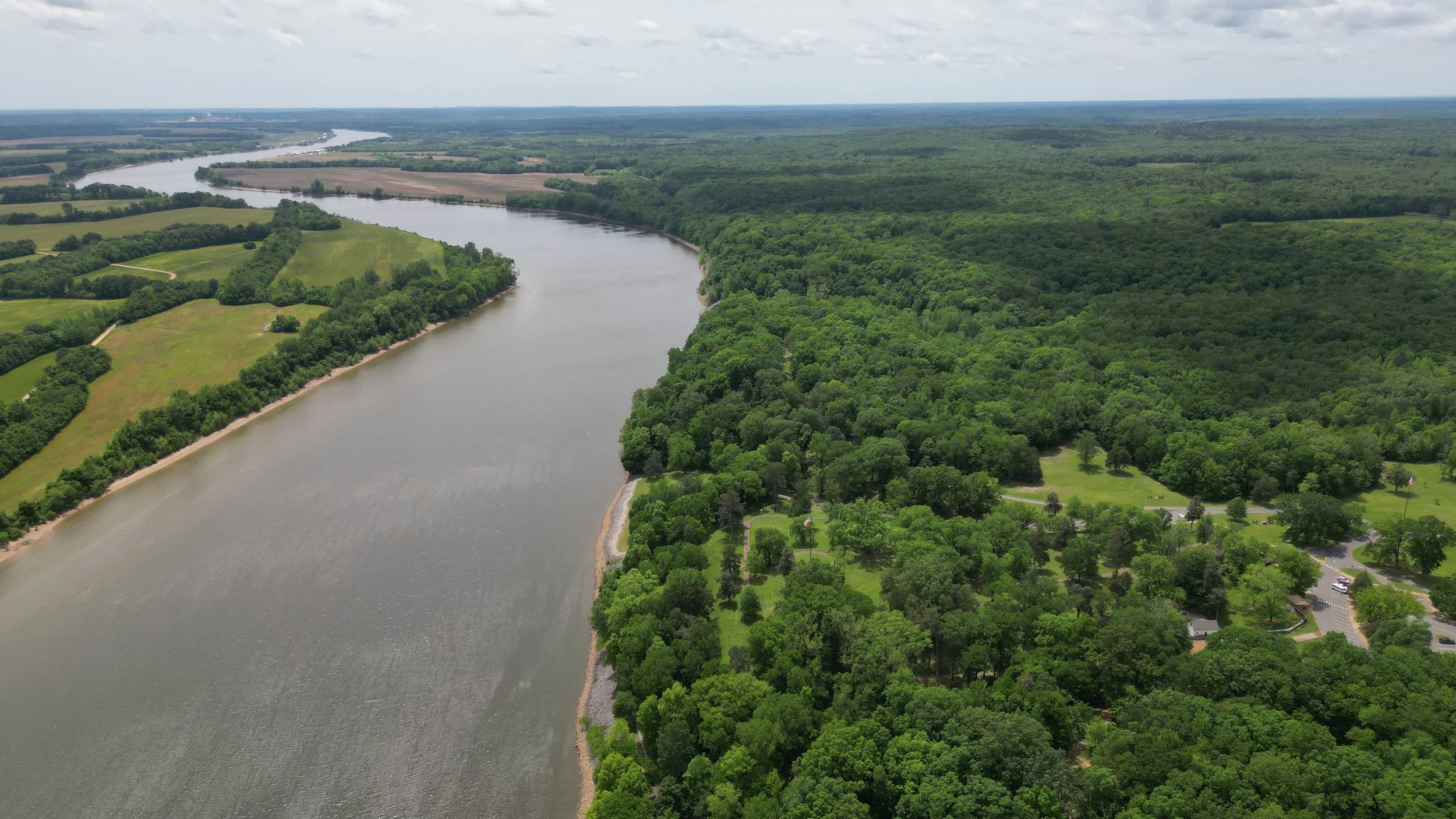
The Tennessee River stretches 652 miles through four states, shaping communities, ecosystems, and economies along its course.
As a first step in developing the Planning + Design Guidelines, the team compiled an Existing Conditions report that explores the river’s history, culture, ecology, management, recreation, demographics, and economic roles, revealing how its past and present are deeply intertwined.
River As A Way Of Life
For millennia, Indigenous peoples lived along the river, until forced removals like the Trail of Tears reshaped the region.
Later, the river played roles in the Civil War and 20th-century modernization through the Tennessee Valley Authority (TVA), whose dams redefined not only the river’s flow but also the social and economic development of entire communities.

The Tennessee River has been an anchor for settlement throughout the region for the past 8,000 years. It has served as the backdrop to the development of unique cultures and traditions, and as the stage for pivotal historic events.

Throughout time, the river has carved its way through ridges and valleys to form the course we know today.

From early Indigenous stewardship by Cherokee, Chickasaw, and Creek nations to colonial conflicts and forced removal, the Tennessee River Valley’s history reflects centuries of cultural exchange, displacement, and shifting patterns of control.

During the Civil War, the Tennessee River was a strategic corridor for transport and warfare, hosting major battles like Shiloh and Chattanooga that solidified Union control of the South and devastated regional cities.

The creation of the Tennessee Valley Authority in 1933 transformed the region’s economy and ecology, turning the river into a managed system for power generation, flood control, and rural development.
From River To Reservoir
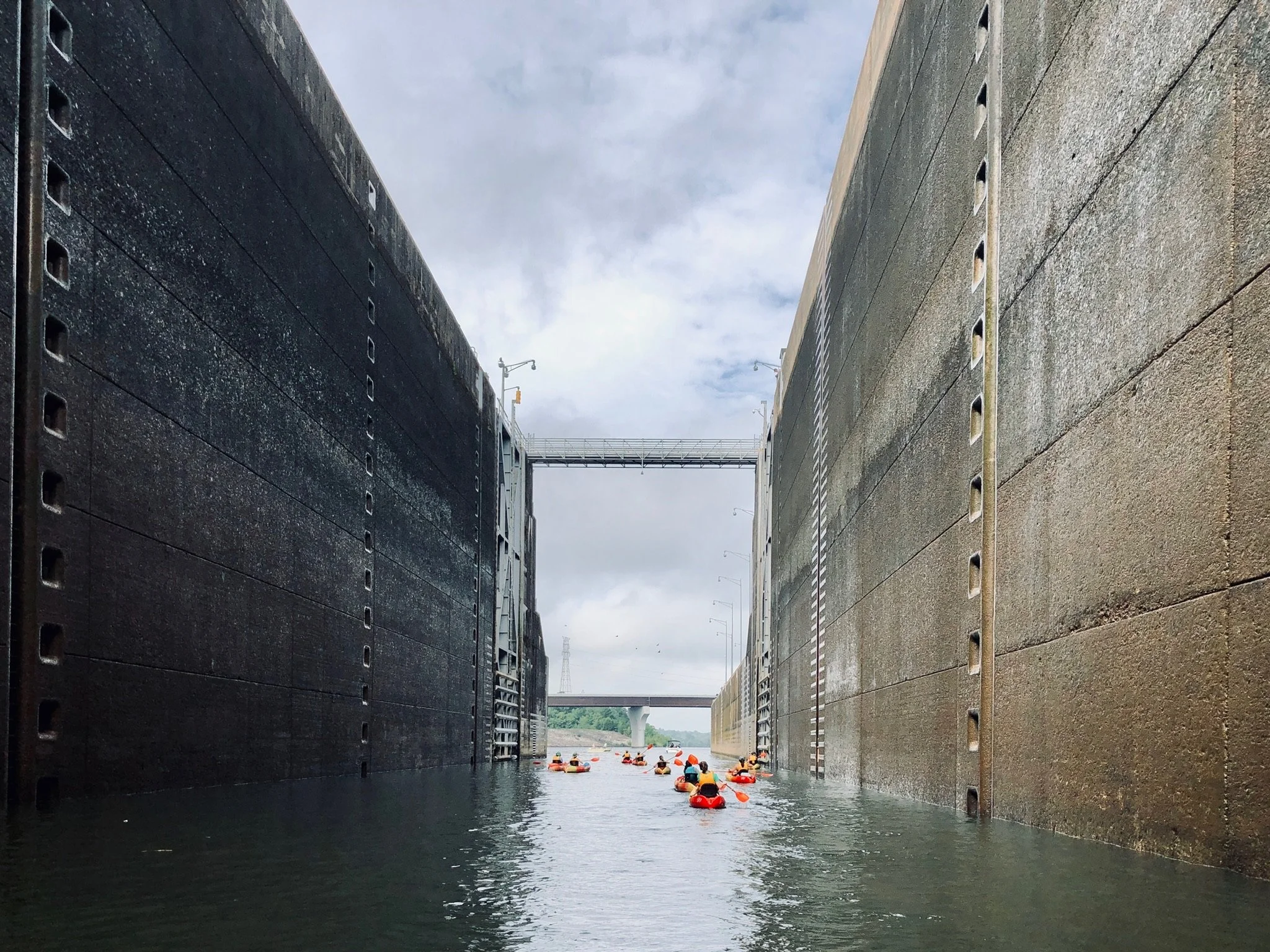
Management of the river today is shared by the Tennessee Valley Authority (TVA), state and federal agencies, and private landowners, finding a delicate balance between energy production, navigation, ecology, flood control, and recreation.
These overlapping jurisdictions pose both challenges and opportunities for coordinated planning, especially as environmental, energy, and recreation pressures evolve.

Today, the river functions as a complex network that provides hydropower, flood control, and recreational access across hundreds of thousands of acres of managed TVA land.

Beyond TVA holdings, the Tennessee River Valley includes a diverse array of local, state, and federal public lands that connect communities to the river and its tributaries.
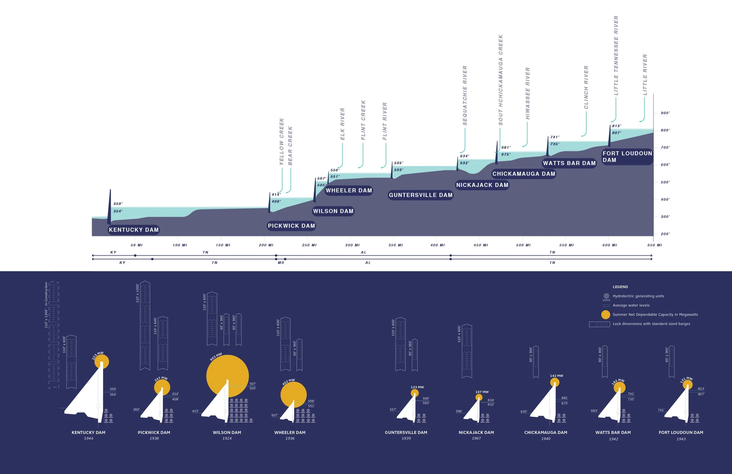
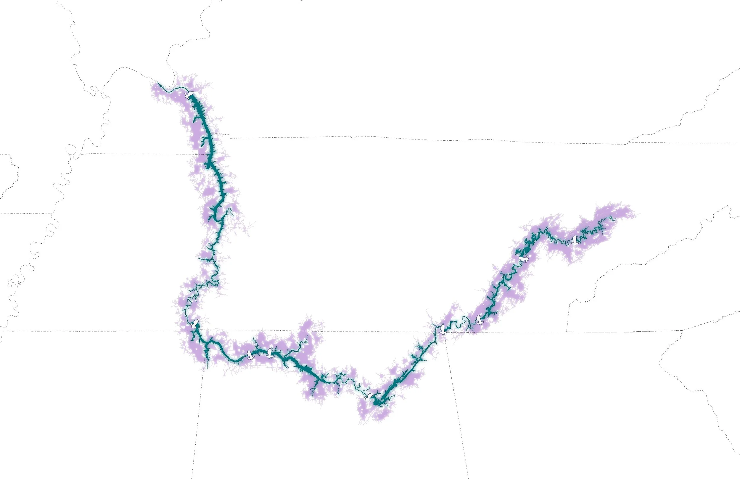
The Tennessee River today is made up of a series of nine reservoirs, each with its own character and landscape, forming a sequence of distinct yet interrelated lake environments.
These reservoirs have become hubs for recreation- places where people fish, paddle, and explore the river’s changing waters.
A Fragmented River Basin
The Tennessee River Basin is one of the world's most ecologically rich regions, hosting unique species across varied landscapes from mountains to wetlands.
However, the shift to dam-controlled reservoirs has altered ecosystems. Some species have adapted to these lacustrine environments, while others have declined due to habitat fragmentation, pollution, invasive species, and disrupted hydrology.

The Tennessee River system forms a diverse mosaic of terrestrial and aquatic habitats that vary dramatically in topography, vegetation, and species richness.

The Ecological Sensitivity study highlights conditions and vulnerabilities across the river system, offering guidance to balance biodiversity and resilience with future shoreline development and community access.
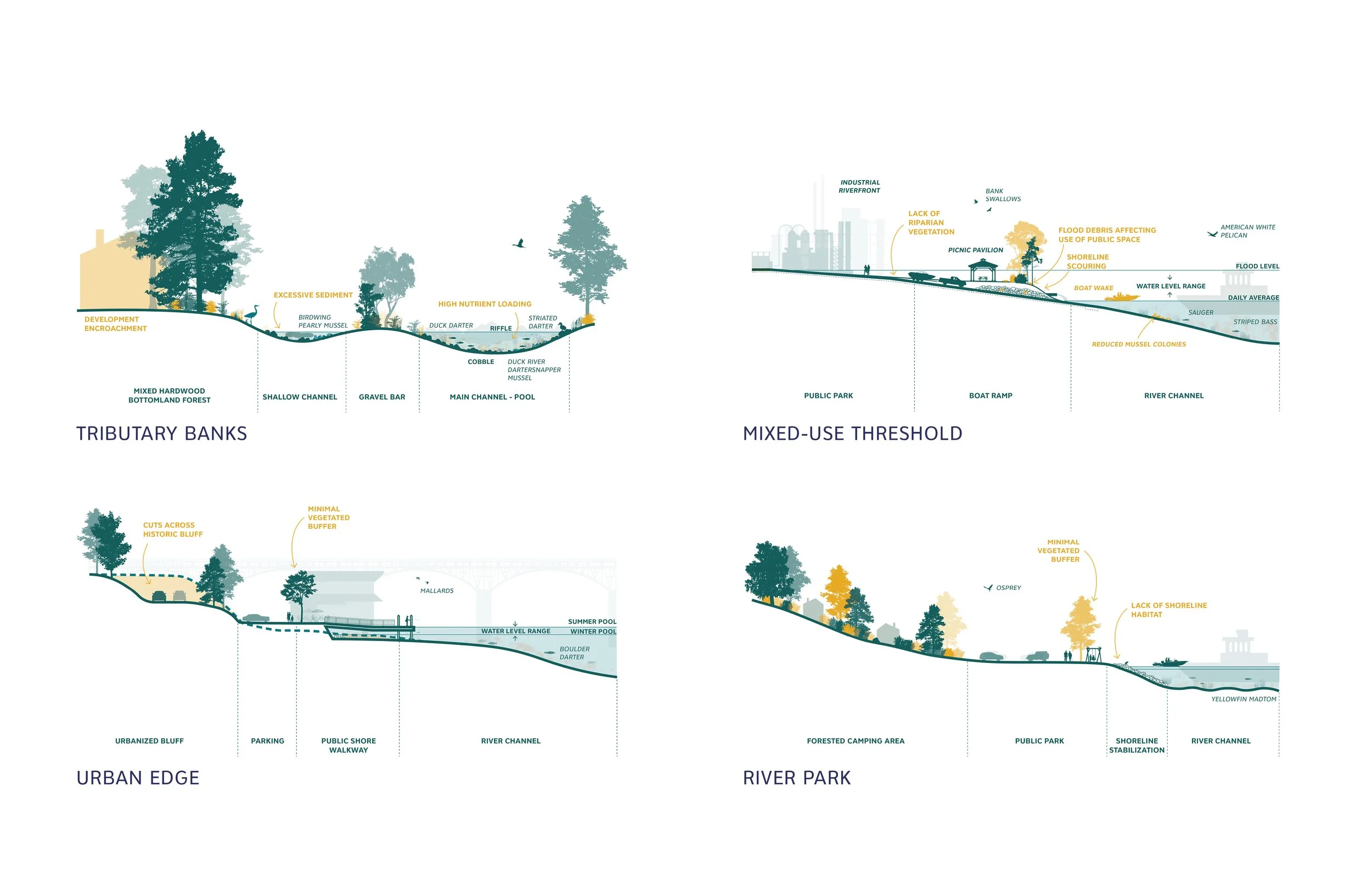
The construction of dams shifted the river’s natural riparian edge upward, replacing lowland habitats with upland ones and creating a significantly altered and stressed river corridor.

Dams, by their nature, disrupt the flow of water through the system and disconnect aquatic communities, though strategies have been implemented to mitigate ecological impacts.
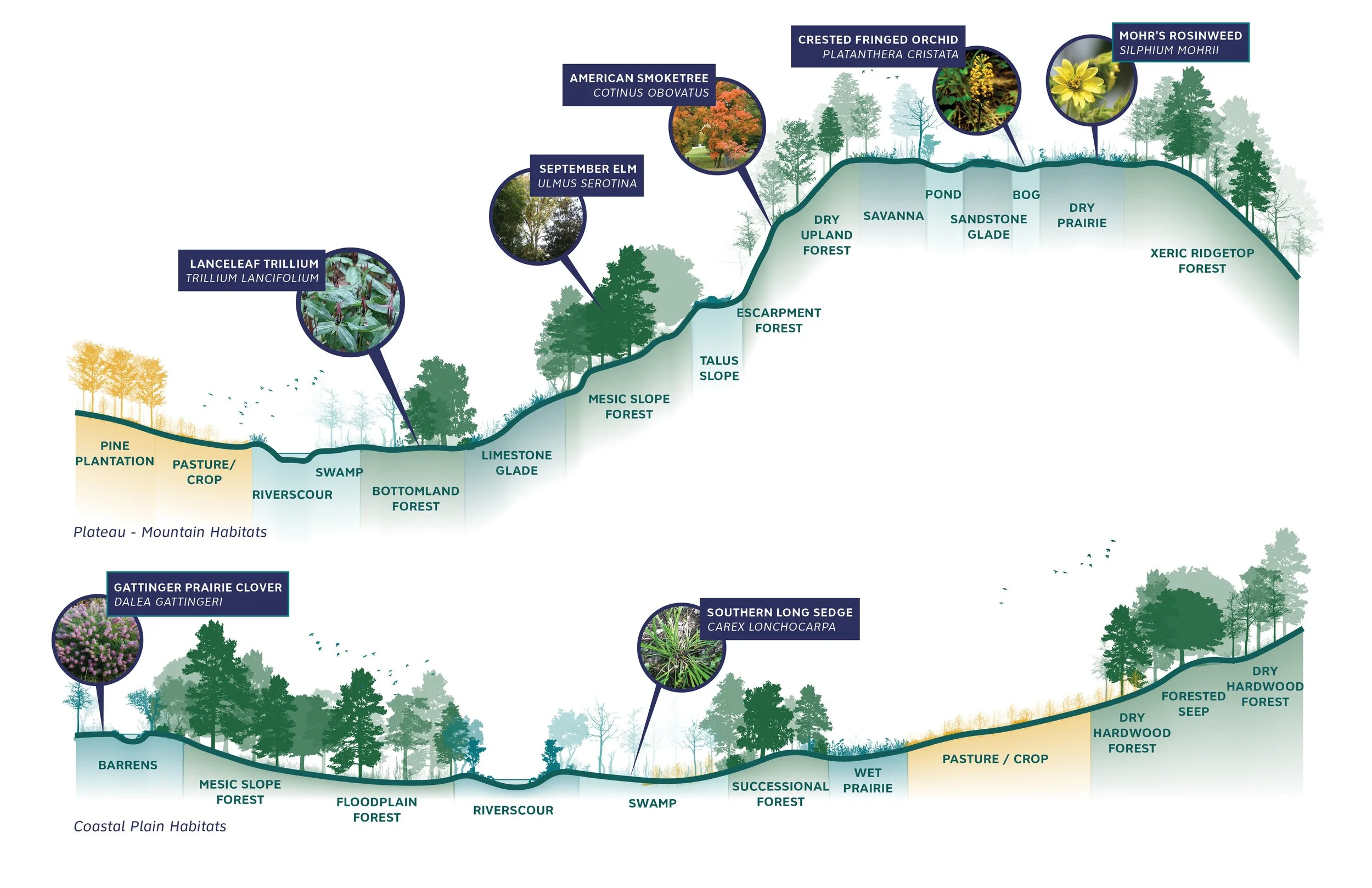
Beyond its riparian edge, the river valley unfolds into layered upland and lowland ecosystems, forming one of the most ecologically diverse landscapes in the region.
The River as Park
The Tennessee River is both a vital economic corridor and a recreational destination, but access is greatly varies along its reach.
While some stretches support well-developed recreational economies, others remain underutilized or inaccessible due to shoreline privatization, lack of infrastructure, or environmental degradation.
Today, the river offers a range of access points, though these opportunities are not evenly distributed.

To understand how people actually reach the river- and where access remains limited- the team studied the region’s driveshed network.

The team also examined different typical types of access and their distribution across the region by mapping concentrations within each lake segment.
A Delicate Balance at Risk
Pollution, aging infrastructure, and legacy land-use decisions create uneven environmental risks across the basin.
Without coordinated resilience strategies, communities and ecosystems remain vulnerable, but basin-wide planning could unify restoration, infrastructure, and health goals.

The Tennessee River is a complex, highly managed system facing mounting pressures as environmental conditions across the region continue to evolve.

Rising heat and more frequent flooding are expected to intensify these challenges in the years ahead, with many impacts already visible today.

At the same time, many tributaries remain impaired by historic contamination, while the river itself is under constant strain to supply drinking water, buffer increasingly intense floods, and sustain recreation and habitat.
Read the Full Document
Access the complete Tennessee RiverLine Existing Conditions Report on our Resources Portal. The full document provides an expanded background that complements this summary.
